


Overview
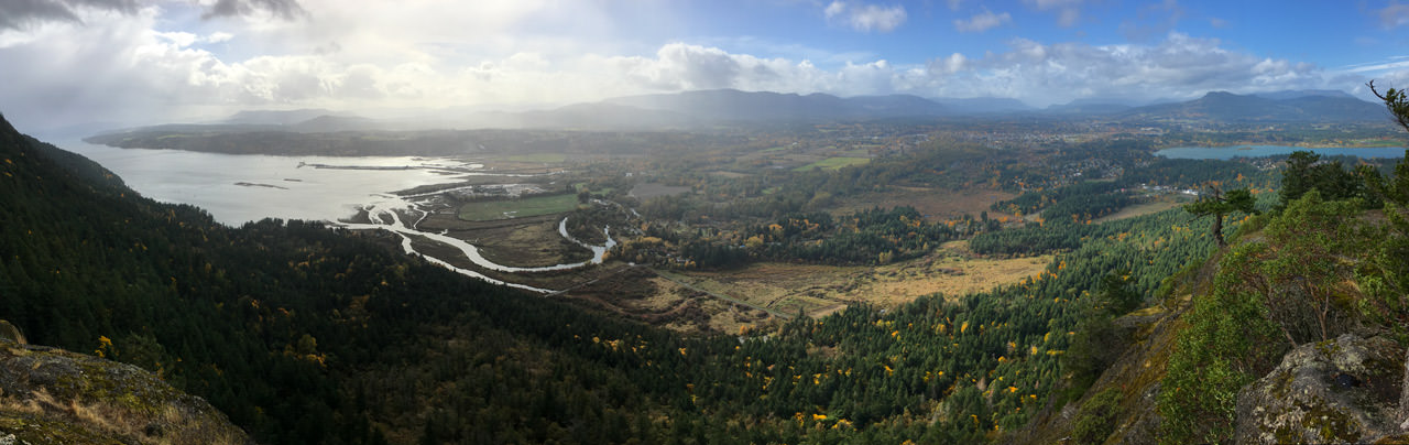
The hike to the cross on Mount Tzouhalem provides and incredible view of the Cowichan Valley, spanning from Cowichan Bay to west, across the valley to the town of Duncan. The route offers a great workout and is an enjoyable, uphill hike through the forest before being rewarded with one of the best views from the area.
There are quite a few trails on Mount Tzouhalem and they are not always marked, so make sure you are prepared with detailed instructions. The trails are shared with mountain bikers, so be aware when hiking on the trails in the park.
From the parking lot area, walk past the metal gate and begin hiking up the wide dirt road. Stay to the left at the first junction, continuing to follow the wide road uphill. After a short climb, watch for a trail to the right with a sign on a tree titled "Old Mil". Go right and follow this trail. Almost immediately after leaving the dirt road, go right at a second junction and continue hiking through the forest as the trail gains minimal elevation through this section.
When you reach another junction, follow the route to the left that goes uphill along the rocky trail. The trail climbs steeply through a portion of this section until it reach another junction with signs on the trees. Go straight onto the trail labeled "Branch D", leaving the Old Mil trail.
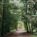
The Branch D trail continues to climb, making its way through the thick, lush west coast rain forest. The trail arrives at an area where dozens of rock Inukshuks and other statues have been created by fellow hikers and mountain bikers. Stop to admire the creations and perhaps find some rocks to build your own.
Continue following the trail as it climbs through a steep section before reaching a high point and then passing through a relatively flat section, where you quickly make time. At the trail junction, go right and continue hiking through the forest to another junction, where you go right once again. The trail begins to make its way around the rocks and climbing up onto a bluff, you can enjoy the first viewpoint in the area.
Return to the trail and follow the worn path as it makes its way along the ridge, wrapping around a large rock and arriving at the cross. From the viewpoint at the Mount Tzouhalem cross, you can look across towards Cowichan Bay and westward across the valley towards Duncan.
After enjoying the view at the cross, follow the route back the way you came, walking around the large rock and following the trail back along the ridge. Back in the forest, continue left at the first two junctions, then along the flat section, before descending towards the Inukshuks. Pass the rock statues and follow the trail as you quickly descend, going straight at the junctions until you reach the wide dirt road. Go left and down the dirt road, returning back to the parking lot area where you began.
Driving Directions
Mount Tzouhalem is located north of Victoria and east of the community of Duncan, BC.
From Victoria, drive to Douglas Street and head northbound, leaving the city as the road becomes Highway #1. Follow the highway for about 50km north, passing through Goldstream and the Malahat.
At the traffic lights at an intersection with a Co-op gas station, turn right onto Bench Road. Follow Bench Road to a stop sign and turn left onto Cowichan Bay Road. Continue driving along Cowichan Bay Road and go straight at the intersection where the road name changes to Tzouhalem Road. Continue to follow Tzouhalem Road for about 5km.
Turn right onto Maple Bay Road and follow this route until you reach Kingsview Road. Turn right onto Kingsview Road, then drive straight through the roundabout and continue straight past the elementary school on your left as you drive up the hill.
Turn right onto Sansum Drive and then at the first street, make another right onto Salish Road. When you reach the stop sign at the end of Salish Road, turn left onto Kaspa Road and rive up to the end of the street in the cul-de-sac. There is a dirt drive way with signage for the Mount Tzouhalem parking lot. Drive up the dirt drive way and find a place to parking, ensuring not to block access to the driveway and the metal gate.
Additional Information
Dog-Friendly
Dogs are permitted on the trails on Mount Tzouhalem but keep them under control at all times. Trails are shared by hikers and mountain bikers and dogs not in control can pose a safety danger. Please ensure to pick up after your dog and remove all excrement and plastic bags from the park.
Toilets
There is an outhouse near the parking lot area, to the side of the metal gate. There are not other toilet facilities on the route to the cross on Mount Tazouhalem.
Although we try to keep information as current as possible, www.victoriatrails.com makes no warranty or representation as to the availability, quality, fitness for purpose, conditions or accuracy of the information provided with respect to this trail or trails. The information provided herein is further subject to our Terms of Use.
Comments
Add Comment | View All Comments
3.67 out of 5 - 3 reviews