
Victoria, BC, has an incredible number of hiking trails, many of which are accessible year-round and have stunning views and trails through beautiful west coast rain forests. Whether you’re new to Victoria, visiting, or haven’t hiked much in the area, these are some of the trails to try. For a much larger list of hikes, visits our trails page where you can sort and filter the list of trails in the region by difficulty, time, distance, and more.
Goldstream Railway Trestle
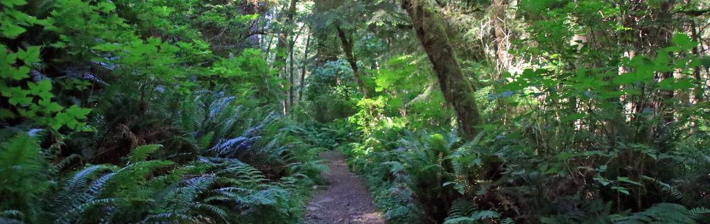
The hike to the Goldstream Railway Trestle is popular amongst locals because it ends up at an impressive train trestle bridge that pass over Niagara Canyon. It also passes near the impressive Niagara Falls, a narrow waterfall that drops from the rocks high above. Begin this hike from the Goldstream Provincial Park day-use area and make your way to the other side of the highway to the waterfall. Afterwards, hike up on the north side and follow the trail uphill as it crosses a bridge and continues up past a junction towards the trestle bridge.

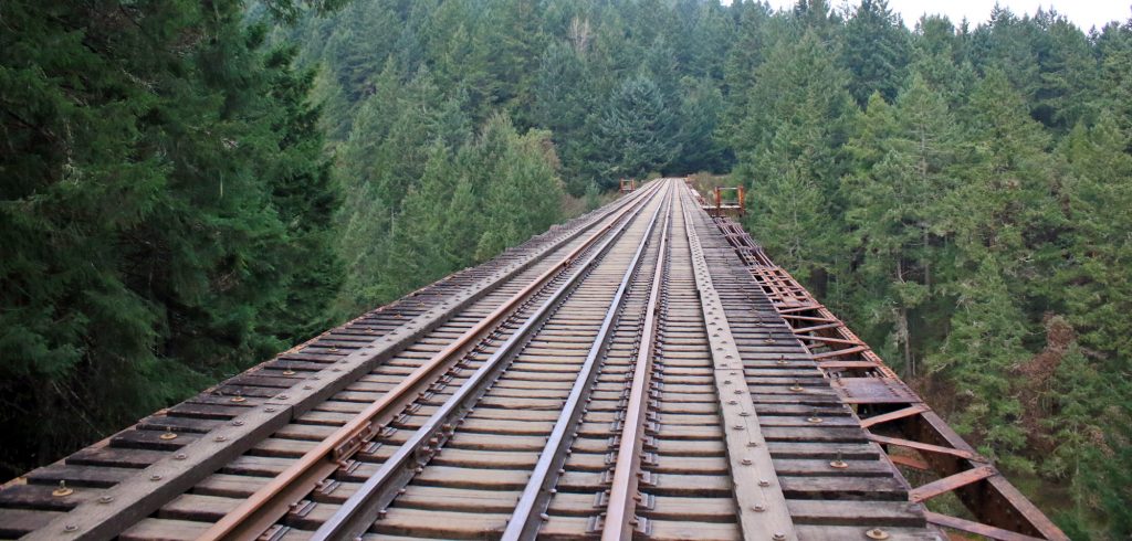
The Goldstream trestle bridge.
It’s important to note that as of 2016, the railway is not in operation along this route, however this could change. Also, it’s recommended that people do not venture out onto the bridge due to the danger of falling over into the enormous canyon below.
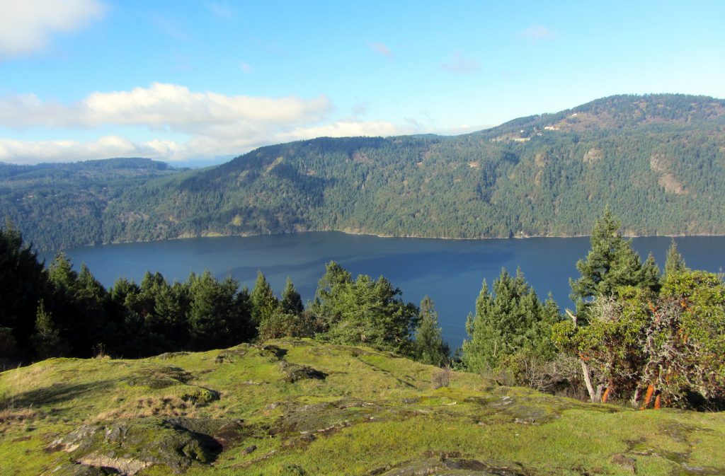
Mount Finlayson
One of the steepest hikes in the area, the challenging hike up Mount Finlayson is best done during good weather when you can enjoy the views from the top. Begin the hike from the Goldstream day-use area and walk over the paved bridge, following the paved road near the entrance to the parking lot. When you reach a trail sign on your right, this marks the start of the steep incline.

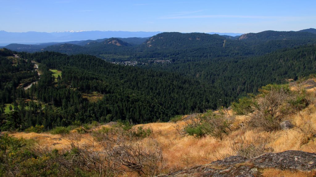
A view from the top of Mount Finalyson.
The first half isn’t too bad as it follows forested trail. The second half can be challenging as it opens onto exposed rock and some scrambling with your hands is required. Follow the trail markers and soon you’ll be at the top, enjoying the scenic view.
Coast Trail
The Coast Trail is located in East Sooke Park and follows the coast along the Strait of Juan de Fuca for 10km. The trail is rugged in sections with lots of ups and downs, climbing over rocks and along uneven terrain, so it’s recommended to explore this trail in sections by using the interior forest trails to make a loop. From the south end of East Sooke Park, starting from Aylard Farm and hiking along the Coast Trail to Beechey Head before returning offers a great hike. From the north end of East Sooke, begin from the Iron Mine Bay parking lot area and then do the hike to Mount Maguire before looping down to the Coast Trail and returning via Iron Mine Bay.

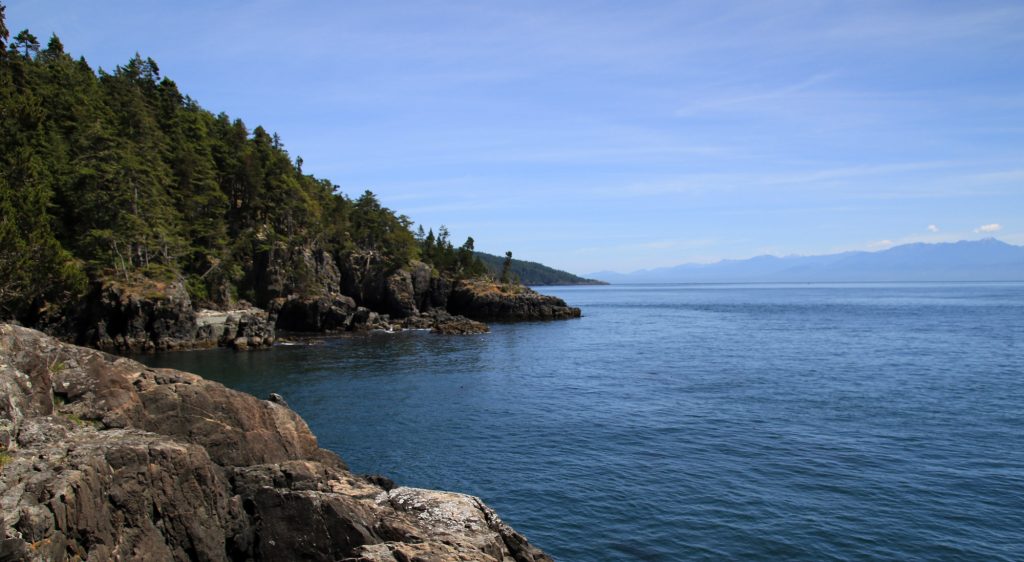
A view along the Coast Trail in East Sooke Park.
If you plan for a long hiking day, it’s possible to do the Coast Trail in one direction than return via the interior trails, however be prepared to hike more than 20km and start early in the day.
Jocelyn Hill
Located in Gowland Tod Provincial Park, the hike to Jocelyn Hill can either be done from the south from Caleb Pike or from the north from McKenzie Bight. Both routes are very good and have their advantages and it’s hard to say which is “better”.
From Caleb Pike, the trail climbs uphill to Holmes Peak before continuing along through the Provincial Park. There are many incredible views of Saanich Inlet below but the best is just after hiking up a steep, rocky section, where the trail opens up for a great view looking far in both north and south directions.

The view from Squally Reach along the trail to Jocelyn Hill from McKenzie Bight.
From the north at McKenzie Bight, hike through the scenic forest, across the wooden bridge and go left as the trail then heads up a long uphill section. You will want to go right to the Squally Reach Viewpoint where you get one of the best views of Saanich Inlet in area. Continue back along the trail until you reach a junction, then go right and up the hill. The trail will wrap around the peak, which isn’t noteworthy, but continue until you reach an incredible view to your right. It is here you will want to stop before retracing your steps back to the McKenzie Bight area.
Mount Work via Munn Road
Mount Work can also be accessed by two different routes, either from McKenzie Bight or from Munn Road. Both hikes are a common exercise
From the McKenzie Bight area, the trail starts from the the wooden sign board in the small parking lot. Follow the wide trail a short distance until you reach a junction, then go right and follow this trail right to the top. The top of Mount Work is marked on a rock as the Summit, however there is no view at this highest point. The best view is beyond the summit (if you came from McKenzie Bight) a short distance where the trail opens up to a clear view of the Saanich area.

The view of the Saanich area near the top of Mount Work.
Hiking from the Munn Road area to the top of Mount Work is also very scenic. From the parking lot, the trail follows a fairly flat route before crossing a wooden bridge and passing through a mossy forest. You gain plenty of elevation through the next section but the hike is enjoyable in the forest. The trail eventually climbs up onto a rocky bluff with an incredible view of the Saanich area. You can continue a bit further to the peak but, as mentioned above, there is no view and just a sign on one of the rocks.
What trails have you hiked and recommend in the Victoria area?